Contact
We're here to help and answer any question you might have. We look forward to hearing from you. 😊
Our Address
MacArthur Hwy, Angeles, 2009 Pampanga
Email Us
icare@gmail.com
Call Us
+639 987 654 321
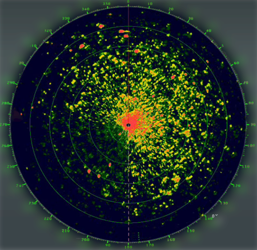
Radar Markings is a feature of the Radar System that shows the damaged location in our Bodies of Water. It also predicts the estimated range of effect and the level of severity of the phenomena.
Radar Markings will work together with Smart Track to identify damaged areas in our Bodies of Water. It will act as a messenger between areas. By feeding it with data using Machine Learning, in the future it will learn the ability to predict the severity of the damage and its long term effects.
The level of severity will be classified into:
1. Red - Long Term Damage to our Bodies of Water
2. Yellow - Short Term Damage
3. Green - At Good Condition
We're here to help and answer any question you might have. We look forward to hearing from you. 😊
MacArthur Hwy, Angeles, 2009 Pampanga
icare@gmail.com
+639 987 654 321